June passed in a pleasant blur of calm days at Mur Crusto, interrupted by the hectic (though enjoyable) week in balmy Italy. I spent my days happily pottering in the garden, reading, and walking through Llangybi and surrounds. Over breakfast, I regularly battled two mischievous squirrels determined to eat all of the nuts left for the wild birds. I made firm friends with Francis the duck and his two mistresses and enjoyed checking the progress of all the fruit and vegetables in the garden. After my flying visit to Italy, Lyndsay popped over to France to visit her aunt Mary (the same amazing aunt who hosted us in London in the Plaza). While she brandished baguettes and wine over on the continent, I finally got down to business and organised several WWOOFing placements in Wales and Scotland (more on that later).
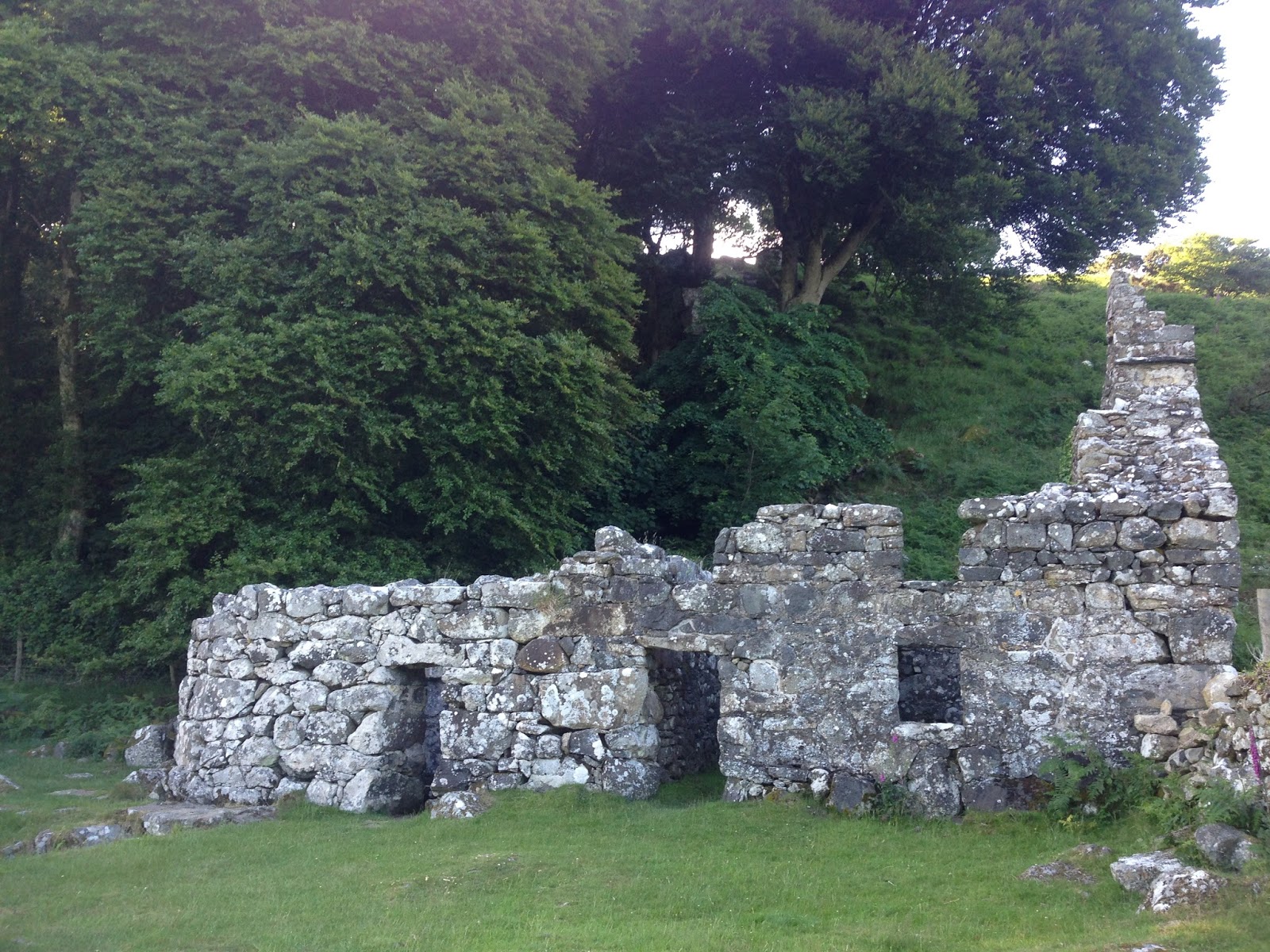
A favourite local haunt was a climb up the nearby hill for a stunning vista over the sea and the Snowdon mountain range. The remains of Carn Pentyrch, a stone-walled Iron Age hill fort, sprawl over the summit, tended by roaming sheep. At the base of the hill are the ruins of St Cybi’s Well, who is thought to have settled in this area of Wales in the 6th century. It served as a place of pilgrimage until as recently as the 18th century, with its water reputed to have healing powers. I didn’t drink any due to the scary-looking algal population, but regularly passed by appreciatively nonetheless.
 |
| View from the nearby hill to the sea, including part of Carn Pentyrch. |
 |
| View from the hill to the mountains, including part of Carn Pentyrch in the foreground. |
 |
| Ruins of St Cybi’s Well, Llangybi. |
Eventually July came around and before we knew it Val and Bry were on their way home from Scotland. After weeks of dreary rain and wind, summer unexpectedly arrived with temperatures in the mid to high twenties. It was unbelievably lovely, and Val and Bry returned on the 7th July to an immaculately weeded garden plot bursting with produce. The strawberries decided to ripen and suddenly there were bucket-loads of sweet, tasty tomatoes, eggplants, zucchini, capsicum and early carrots. It was heavenly. Val and Bry very kindly insisted we stay on for a few more days to explore more of the Snowdonia region and I had an absolute blast. The highlights were definitely conquering Mt Snowdon and hiking with Val and Bry along the coastal peninsula.
Mt Snowdon
Bry is a seriously knowledgeable geologist and kindly drove Lyndsay and I out to the base of the Watkin’s Path, the trail leading to the top of Mt Snowdon. He lent us a copy of his incredible book Snowdonia Rocky Rambles: Geology Beneath your Feet and gave us a crash course on the trail and the rocks to look for. Here’s a link to the book online: http://www.amazon.co.uk/Snowdonia-Rocky-Rambles-Geology-Beneath/dp/1850584699. I couldn’t resist including a picture of the cover here as well. The entire book is studded with photos of Bry and Val hiking twenty odd years ago.
 |
| By the one and only Bry Lynas. That’s Val on the cover! What a stunner. |
Now, Bry and Val advised us not to take the Watkin’s Path (the clearly designated trail with a crippling steep scramble at the summit), but to take one of Bry’s Snowdonia Rocky Rambles. The suggested trail started on the Watkin’s Path, then diverged along the old tramway used for slate production and ascended up and along the ridges of the next few mountains to reach the summit of Snowdonia. This was followed by a descent along the Watkin’s Path to the base of the mountain. Armed with Bry’s published description of the topology and geological landmarks, a map, 2 litres of water and a packed lunch, we set off a bit after 8.30am on the 9th July. From the lake at the base of the mountain, the summit seemed a very long way away. People die every year attempting the climb. Bry encouraged us to step over the corpses as he drove back to Mur Crusto, wistfully wishing he was joining us.
We started out along the trail in good spirits and trekked up a steep boggy hill through the forest and ascended into a series of fields with staggered trail signposts. After several hours of investigating landmarks possibly the ones described by Bry, we pulled up by some ruins and abandoned mine shafts to re-assess the map. It was not a good start to find we were well lost. Luckily, after several hours of not spotting a soul, a shirtless man from Anglesey appeared from around the corner and turned us around in the right direction. After a frustrating back-track with our Anglesey saviour, we emerged onto the correct trail. It was big. Filled with hikers. All very obviously a signposted route to the summit. We thanked shirtless Anglesey man profusely. He tipped his hat and huffed along on his way as I gazed in wonder at the staggering peak of Mt Snowdon high above.
 |
| Climbing Snowdon,: lost but it’s still oh so beautiful |
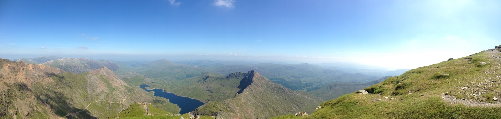
Now we were in business and could identify all the landmarks in Bry’s guide. Leaving the signposted Watkin’s Path, we climbed up the old tramway to run parallel with the prescribed route to the summit. The hardest part of the climb lay ahead as the tramway ended in an extremely steep hillside leading to the first of six or so sheer, rocky ridges ascending to the summit of Mt Snowdon. It was so very very high (1,085 m high to be precise). With an extreme effort, we managed to climb to the base of the first ridge. We gradually tackled the ridges one-by-one, having to scale the rockier sections using our hands.We pulled Bry’s book out from time to time to more fully appreciate the different types of granite and quartz intrusions as we sucked in air and downed water. Geology is hard work. Somehow I managed to keep climbing, and after the most gruelling ridge I emerged onto a narrow goat’s track from which the mountain simply fell away on both sides. I almost couldn’t believe my legs had propelled me this high. We pushed on and made it to the summit, which was choked with people due to the small funicular railway that also runs up the back of the mountain (and significantly disturbs the serenity of the vista). Scrabbling around the loose shale, we also found several fossil brachiopods for Bry’s perusal (NB he was extremely proud of his pupils).
 |
| Bry’s Snowdonia Rocky Ramble route. We climbed up from the old tramway near the quarry and then up and along these ridges to the summit of Mt Snowdon, which is even higher up (out of frame to the right). |
 |
| On the narrow goat’s track along the ridges, nearly at the summit of Snowdon. |
 |
| View from the summit of Snowdon. |
After 6 hours of hard ascent, we collapsed onto the grass at the summit around 2.30pm for a well-deserved lunch and rest. It was a phenomenal view, made all the more amazing by knowing I had climbed to see it. After an hour or so, we began the descent via the Watkin’s Path. I am so glad we didn’t follow the Watkin’s Path up Snowdon, because it was terrifying enough picking my way down the sheer slope of scrabbly, loose scree. The hikers we passed travelling in the opposite direction wore uniform expressions of despair as they came face to face with this impossible slope after hours of hard climbing already. It felt good to be going down. It only took several hours to descend the mountain, stopping once or twice to look at abrasion marks on rocks left by the last glacial retreat (thanks Bry!). Stiff and sore, we yanked off our shoes to dangle our feet in the cool mountain-fed springwater river. It was truly wondrous. Despite the difficulty, it was a day filled with sunshine and stunning views, compounded with an incredible sense of achievement. I’m still slightly incredulous that I managed it, to be honest. It was with a dazed, daydreaming air that we met Val for the ride back to Mur Crusto. Val and Bry are some seriously fit retirees to be able to climb Snowdon.
 |
| The descent: the ridges in the background are the ones we climbed to reach the summit of Snowdon. That’s Lyndsay on the right. |
Hiking with Val and Bry
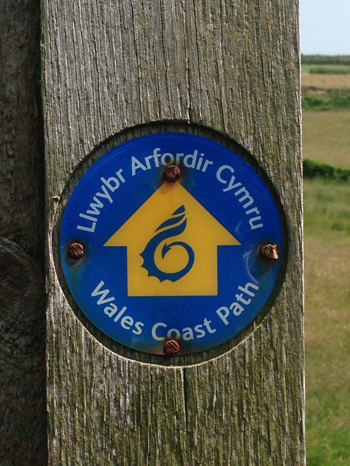
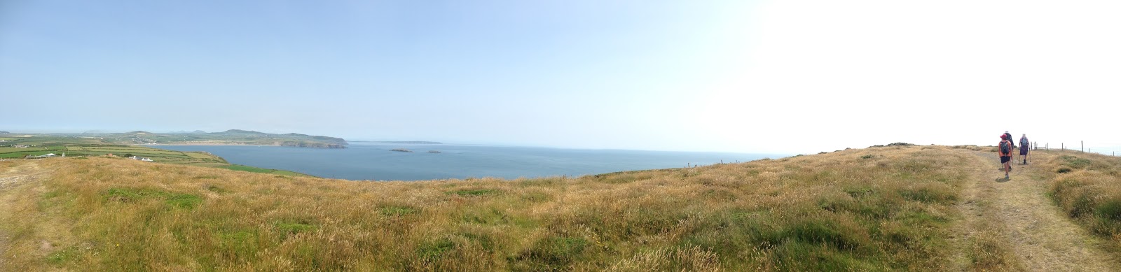
Lyndsay and I were lucky enough to go hiking with Val and Bry (in person this time) on the day of their 45th wedding anniversary, and on the 10th July we headed out to the coast path near Bardsey Island, off the tip of the Llyn Peninsula. Bardsey Island has been a place of Christian pilgrimage since the middle ages and is said to be the burial site of 20,000 ‘saints’. In the middle ages, three pilgrimages to the monastery on the island were equivalent to a single pilgrimage to Rome! Along the coast path is the ruins of St Mary’s Abbey, and there is a holy well in a niche of the cliff face below the high tide level. It’s fed from a spring and looks like a tucked away rock-pool from a distance. Hard to get to but pretty stunning. We walked along the coast path to the peninsula and back and even spotted an inquisitive seal and several dolphins (after Bry urged us to look out for cetaceans). It was a lovely day to spend in the sunshine with such spectacular coastal views.
 |
| Wales Coast Path signpost. |
 |
| Val and Bry on the look-out for cetaceans. |
 |
| Val, Bry and Lyndsay on the coastal path. |
 |
| Stunning views from the peninsula. That’s me on the left and Bardsey Island in the background. |
It was strange to eventually say goodbye to Val, Bry and Mur Crusto – it had started to feel like home and Val and Bry like family! It had been a lovely few days with them with plenty of hiking and some delicious meals in the late evening sunshine. I felt very lucky to have been able to spend a month on their tranquil farm and I have learned a lot from their methods of fruit and vegetable gardening and lifestyle. Thanks a lot Val and Bry for such an incredible experience, I’ll never forget you or your kindness!